Log in
All resources
Create a design
9,296 Free Artworks of Map Collection
bibliothèque nationale de france
eran laor cartographic collection
joan blaeu
copper engraving print
british library
1667 maps
victor levasseur - maps of france
fonds ancely - bibliothèque municipale de toulouse - maps
steel engraving print
bibliothèques de toulouse
atlas maior, vol 12 (america) - joan blaeu, 1667 - bl 114.h(star).12
1667 maps
atlas maior, vol 9 (italy) - joan blaeu, 1667 - bl 114.h(star).9
1667 maps of italy
atlas maior, vol 12 (america) - joan blaeu, 1667 - bl 114.h(star).12
1667 maps
atlas maior, vol 4 (netherlands) - joan blaeu, 1667 - bl 114.h(star).4
1667 maps
atlas maior, vol 11 (asia) - joan blaeu, 1667 - bl 114.h(star).11
1667 maps
atlas maior, vol 12 (america) - joan blaeu, 1667 - bl 114.h(star).12
1667 maps
atlas maior, vol 12 (america) - joan blaeu, 1667 - bl 114.h(star).12
1667 maps
atlas maior, vol 9 (italy) - joan blaeu, 1667 - bl 114.h(star).9
1667 maps of italy
atlas maior, vol 6 (scotland and ireland) - joan blaeu, 1667 - bl 114.h(star).6
1667 maps
maps from the mechanical curator collection available to georeference
maps from the mechanical curator collection
1803 in berlin
1803 maps
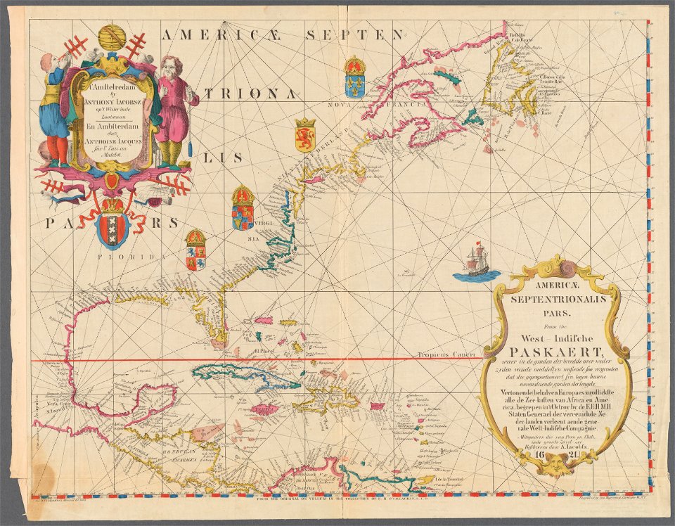
1620s maps of north america
1620s maps of the caribbean
1620s maps of north america
1620s maps of the caribbean
johann christoph brotze
crossing of the düna
eran laor cartographic collection
renaissance
eran laor cartographic collection
william hughes (geographer)
eran laor cartographic collection
william hughes (geographer)
eran laor cartographic collection
joan blaeu
eran laor cartographic collection
cornelis de bruyn
eran laor cartographic collection
cornelis de bruyn
eran laor cartographic collection
william hughes (geographer)
eran laor cartographic collection
william hughes (geographer)
eran laor cartographic collection
william hughes (geographer)
maps of the west-indische compagnie
1671
maps of frankfurt (oder) by braun & hogenberg
maps of wittenberg by braun & hogenberg
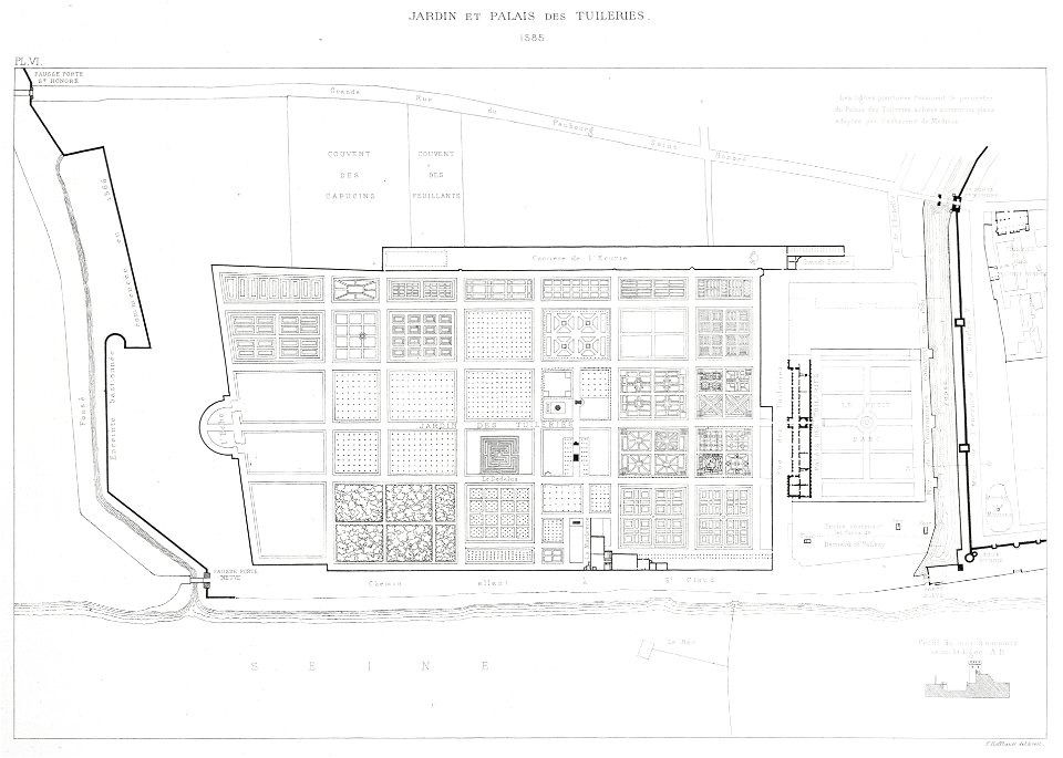
lithographs of paris
floor plans of paris
eran laor cartographic collection
nicolas langlois
maps of the west-indische compagnie
1705
maps by pieter van der keere
old maps of zutphen
maps by pieter van der keere
old maps of flanders
maps by pieter van der keere
maps by abraham ortelius
david rumsey historical map collection
1790s maps of the holy roman empire
lithographs of paris
floor plans of paris
dutch 18th-century prints in the rijksmuseum amsterdam
old maps of amsterdam
turgot map of paris, david rumsey historical map collection – derivative files
île louviers
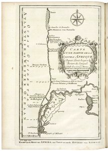
maps of the senegal river
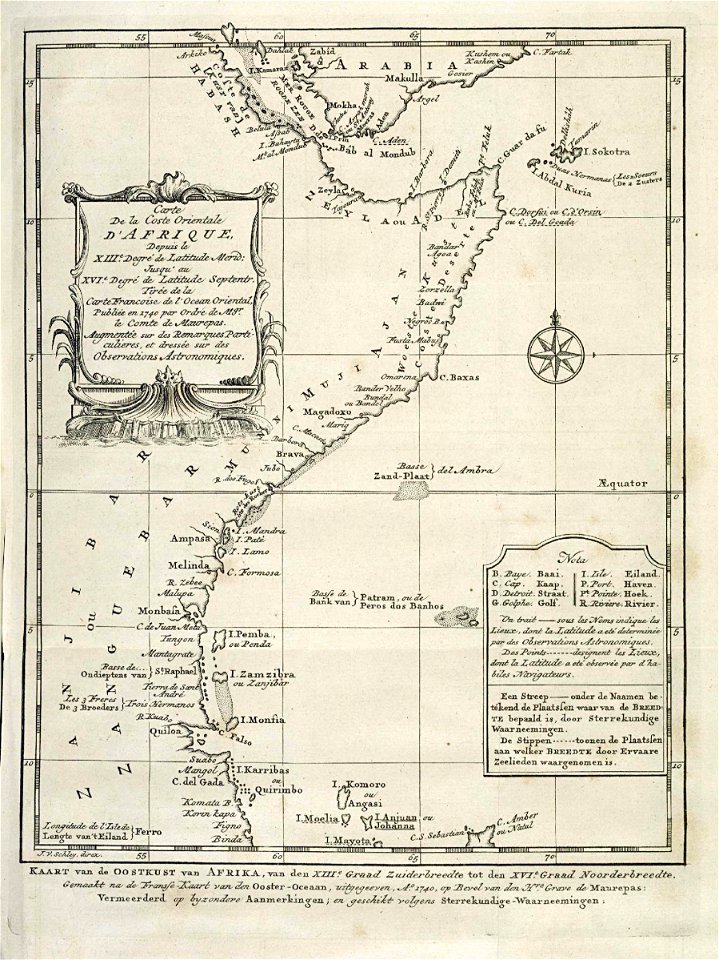
1747 maps of africa
old maps of the dutch east india company - africa
1747 maps of africa
maps of the west-indische compagnie
1757 maps of south america
maps of the dutch east india company - indonesia
18th-century maps of java
maps of paris from the david rumsey historical map collection
maps of île-de-france by françois de la guillotière
victor levasseur - maps of france
coats of arms of perpignan
theatre geographique du royaume de france (1632)
maps of perigord
coats of arms of cities in var
19th-century maps of var
maps of vangiones by sanson
1670s maps of hesse
expeditionis hispanorum in angliam vera descriptio anno domini mdlxxxviii
maps of the spanish armada
expeditionis hispanorum in angliam vera descriptio anno domini mdlxxxviii
maps of the spanish armada
17th-century maps of bretagne
1690s maps of france
map of the circle of austria by sanson
1700s maps of austria
maps by alexis-hubert jaillot
maps by guillaume sanson
maps by juan lopez
1835 maps of spain
atlas minor gerardi mercatoris (1614, maps)
17th-century double hemisphere world maps
gaspard de chabrol
maps from gallica
map of the circle of the rhineland by sanson
1730s maps of rhineland-palatinate
maps of spain by tomas lopez
old maps of gran canaria
maps in the british museum
old maps of hampshire
maps in the british museum
old maps of chester
atlas maior, vol 3 (germany) - joan blaeu, 1667 - bl 114.h(star).3
johannes gigas
atlas maior, vol 3 (germany) - joan blaeu, 1667 - bl 114.h(star).3
johannes gigas
sanson maps of north america
maps by nicolas sanson
sanson maps of north america
maps by nicolas sanson
maps made in the 17th century
bourbonnais (ducato)
beschreibung der städt der welt - braun & hogenberg - btv1b52512111k
maps of trier by braun & hogenberg
sanson maps of north america
maps by nicolas sanson
sanson maps of north america
maps by nicolas sanson
maps made in the 17th century
beauvais (contea)
1760s maps of the iberian peninsula
1762 maps of spain
landais & oberthur
maps from gallica
maps in the british museum
maps by john speed
1610s maps of the holy roman empire
jacques surhon
maps by willem and johannes blaeu
laurens reael
vrbivm praecipvarvm totivs mvndi liber tertivs (1616)
maps of fortress of charlemont by braun & hogenberg
nypl the miriam and ira d. wallach division of art, prints and photographs: print collection
impressionism
atlas schoemaker-noord-holland, amsterdam
history of diemen
old maps of china in harvard map collection
1749 maps of asia
maps by thomas kitchin
1781 maps of europe
maps of the ottoman empire by mercator-hondius
map
eran laor cartographic collection
tranquillo mollo
eran laor cartographic collection
tranquillo mollo
maps by joachim bormeester
1680s maps of the world
atlas maior, vol 4 (netherlands) - joan blaeu, 1667 - bl 114.h(star).4
1667 maps
brazilian paintings in the museu antônio parreiras
pedro ii of brazil and empress teresa cristina
eran laor cartographic collection
isaak tirion
eran laor cartographic collection
emanuel bowen
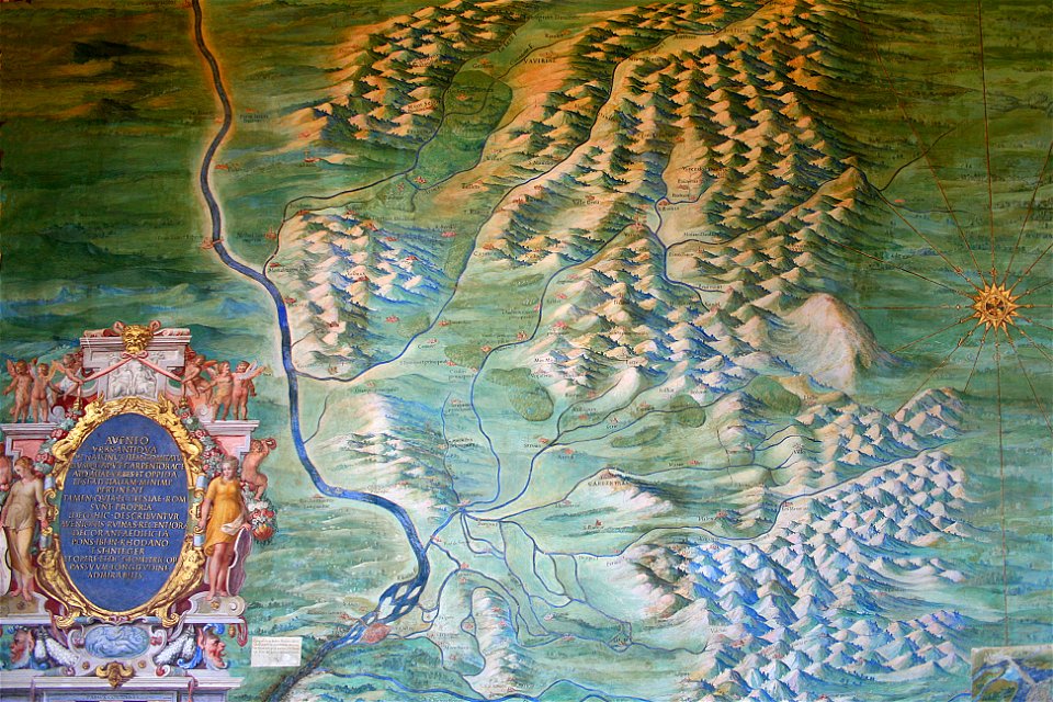
avenionensis ditio et venaisinus comitatus (galleria delle carte geografiche)
maps of comtat venaissin
map of amsterdam by julius milheuser after daniël stalpaert, 1662
engraving
maps of augsburg by braun & hogenberg
eran laor cartographic collection
maps of freiberg by braun & hogenberg
eran laor cartographic collection
maps of cologne by braun & hogenberg
eran laor cartographic collection
portrait paintings of wilhelmine of bayreuth
juda pinhas
maps of the dutch east india company - india
old maps of the dutch east india company
de praecipvis totivs vniversi vrbibvs, liber secvndvs (1575)
maps of kleve by braun & hogenberg
maps by guillaume delisle showing history
old maps of alexander the great's empire
de praecipvis totivs vniversi vrbibvs, liber secvndvs (1575)
maps of wissembourg by braun & hogenberg
de praecipvis totivs vniversi vrbibvs, liber secvndvs (1575)
maps of neuss by braun & hogenberg
victor levasseur - maps of france
engravings by nicolas mignard
coats of arms of cities in ardèche
victor levasseur - maps of france
coats of arms of orléans
gaspard de coligny
coats of arms of cities in drôme
jean étienne championnet
19th-century maps of haute-saône
coats of arms of vesoul
victor levasseur - maps of france
old maps of gironde
2001 - 2100 of 9,296
Next page
/ 93